

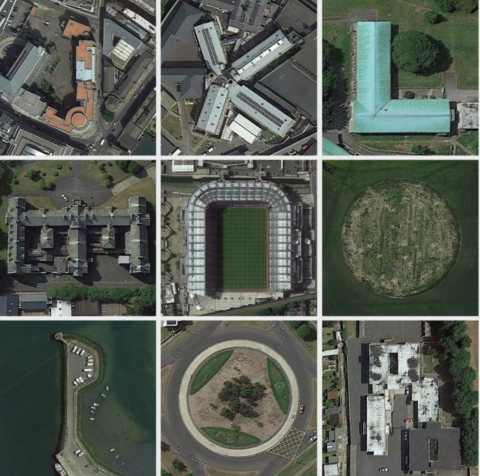
 A ‘Dublin-flavoured topographical alphabet’ by.James Kelleher, inspired by Rhett Dashwood’s Google Maps Typography and Benedikt Groβ and Joey Lee’s Aerial Bold project.
Good luck naming them locations.
Dublin 26: A Google Maps Alphabet (Pilcrow)
(H/T: Rob Dalton)
Sponsored Link

D is clontarf baths.
Nroke Nark
Qalkinstown Qoundybout
Actually.
Not the Qalkinstown Qoundy
H Block?
I think K might be Mountjoy. But I’m not sure and I don’t recognise any of the others at all!
N is Croker, obviously
They should really finish the stadium and make an ‘O’
+1
J-DIT Aungier Street
K-Mountjoy
N-Croke Park
Q-Wellington Lane Roundabout
X-Bangor Circle
Y-Iveagh Trust, Kevin Street
H-Teresas Gardens
V cool. Me likey!
Oh, and the title : )
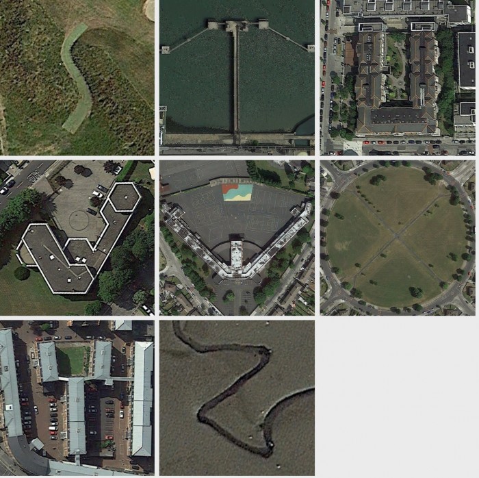
H – The Coombe
L – Grangegorman
Y – the Tolka
*Z – The Tolka
F is dun laoghaire ferry terminal.
Oabra
T is on the port wall near poolbeg station
P is part of Howth harbour
V – German Embassy in Booterstown
G – one of the Trinity Hall buildings
M – Marlborough Hall, Glasnevin
W – that school in Drimnagh, Our Lady’s I think?
this is amazing, well done! are they all real tho or some light photoshopping? :-)
I’d be impressed if the letter was the actual first letter of the place.. e.g. turn that Croke Park one thru 90 degrees for a C etc.
Come back to me when you’ve that sorted.
J is for Jacob’s?
Shurely B is for Bolans….