


Ruth McManus tweetz:
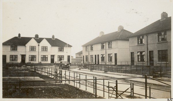
Somewhere in Crumlin… streets hadn’t been named when the photo (top) was taken in 1936. This is the plan from the G&T Crampton archive.
Full sized image here.
MORE: Housing In Dublin in The 20th Century (Irish History Show Podcast)
Sponsored Link


Should you wish to look on Google Earth. Lattitude and Longitude
53°19’24.32″N
6°18’13.71″W
All my street names are in some funny language
Going by the location of the old Clerk of Works office
I’m hazarding a guess that might be the Mt Argus/ Harolds Cross side of Clougher Road
Lower Crumlin if you like
Is this the handwriting of Herbert Simms??
Now THERE is a man who gave his life for Dublin’s poor.
Absolutely unbelievable that there isn’t so much as a bohereen in the city named after him.
crumbling
https://goo.gl/maps/eckzet9yP6VPcrwd8