

Yikes.
Earlier: Ask A Broadsheet Reader
Via Met Eireann


Met Éireann writes:
Very cold and windy tonight, with a mix of clear spells and scattered showers, the showers turning increasingly to hail, sleet and snow in Ulster, Connacht and in north Leinster, with some accumulations by morning.
More persistent rain and sleet will move in across much of Munster later in the night, with some snow, mainly over high ground.
Minimum temperatures minus 1 to plus 2 Celsius, in fresh westerly winds, strong along north and northwest coasts.
Tomorrow, Thursday, will be bitterly cold, with scattered showers, many falling as hail, sleet and snow, some of them heavy and thundery, especialy in the west and north.
Some sunny spells also, especially in eastern and southeastern coastal areas, where the showers will be more scattered.
In Munster and parts of south Leinster, it will be cloudy in the morning, with more persistent rain and sleet for a time, but there is also a risk of snow…

De RTÉ weather on Friday night.
Brrr.
Thanks Leah Burgess

A snowy scene from the Grand Canal in Dublin in December 2010
Well, maaaybe.
Met Éireann says the weather on Sunday will be:
“Bitterly cold and rather blustery. Good spells of sunshine but scattered showers too – mainly affecting the western half of the country. Some of the showers will be wintry in nature, with snow on western and northern hills and possibly some sleet on lower levels here. A flurry or two is possibly on higher ground further east. Highest temperatures just 3 to 6 degrees Celsius, in a fairly fresh westerly breeze. Similar conditions persisting overnight. Cold with some frost as winds moderate, with some snow accumulation possible in the north overnight.”
Via Met Éireann
Pic: Mark Griffin
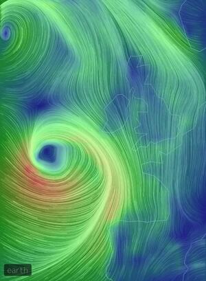
Latest Radar: a band of heavy rain is moving eastwards across the country, clearing from the west pic.twitter.com/XGIHFLVRlY
— Irish Weather News (@iWeatherNews) November 13, 2014
Meanwhile, Met Eireann warns:
Rainfall Warning for Dublin, Louth, Wexford, Wicklow, Meath and Monaghan
A spell of heavy rain on Thursday followed by another spell of heavy rain on Thursday night will give rainfall accumulation of 40 to 60 mm with localised flooding.
Issued:Wednesday 12 November 2014 11:00
Valid:Thursday 13 November 2014 06:00 to Friday 14 November 2014 09:00
*brushes up on junior cert. woodwork course*

A snow warning comes into force later. Mainly a hill/mountain feature, with more than 10cm for some in next 24 hours. pic.twitter.com/NscwEwgGd0
— Barra Best (@barrabest) February 11, 2014
Status Orange.

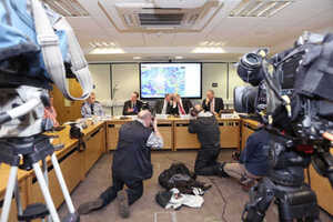
[ The National Emergency Coordination Group Briefing this afternoon. Top from left: Liam Basquille (office of Public Works) , Brian Kenny and Sean Hogan, Dept of the Enviroment, and Met Eireann’s Ger Fleming]
The Government has defended the decision of the National Emergency Coordination Group not to hold until yesterday its first plenary meeting in response to the adverse weather and flooding of the last month.
Fianna Fáil social protection spokesman Willie O’Dea said this morning that he was “gobsmacked” that the group had not met until this month. He was responding to an interview given by the group’s chair Sean Hogan this morning in which he disclosed its first formal meeting had been held yesterday.
Decision not to convene national emergency group defended (Harry McGee, Irish Times)
(Sam Boal/Photocall Ireland)
Incoming! The latest #storm is getting closer. Set to affect the south and east worst #weather pic.twitter.com/v4Xz2klnJe
— Fergal O’Brien (@FergalTodayFM) February 4, 2014
Status Orange.
 Well we wouldn’t want to lose the run of ourselves.
