


Ah here.
The cows?
Authored in 1940 by official (and non-official ) Ireland-based members of the Oberkommando der Wehrmacht (OKW) Nazi German Supreme Command of the Armed Forces.
Published 1941, 1941 and 1942.
Via The David Rumsey [historical archive] Collection:
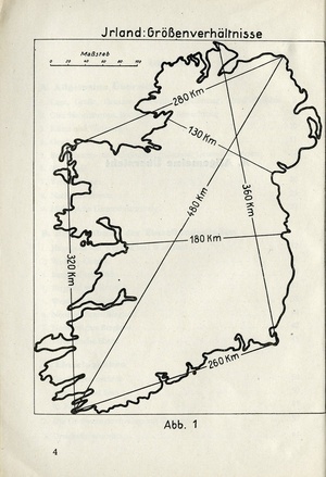
In preparing to invade Britain, the German military preparations included the production of a series of military/geographical assessments, showing what might be found by those arriving. This material was also used in a military evaluation of the regions of the British Isles, and considered each from the viewpoint of invasion….
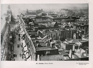
..Such sites are often illustrated in the book of photographs, the captions of which give a map location for each site, and each mapped site gives the book illustration number. The town maps are printed in brown (rather than black), with blue water. The various coloured symbols stand out clearly, are easily seen and are quite striking.
The delicate black bridge symbols are especially noticeable and numerous, as are the red boundaries of railway stations and goods yards. Basically, for each town these maps show all locations that the Germans thought to be strategically important.
Text from the description of the collection compiled in the event of an invasion or Irleand by the Nazis.
Unternehmen Seelöwe (Operation Sea Lion]: the Original Nazi German Plan for the Invasion of Great Britain ( David Rumsey Collection)
Thanks ‘IrishHistoryanon’ (prompted by recent reader query)