

For your consideration.
Seventeenth Century Irish/Hibernian map porn.
Via HeritageMaps:
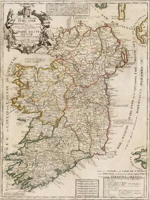
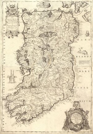
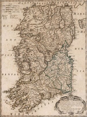
Four maps depicting Ireland in very different shapes – all from the 1690s – by, from top: Visscher, Nolin, Coronelli and Rossi and published in Amsterdam, Paris, Venetia and Roma.
The Nicolaes Visscher map’s short title is ‘Regnum Hiberniae’ and appears courtesy of [David] Rumsey Maps – hi-res available here.
The Vincenzo Coronelli map’s title is ‘Composite: Parte settentrionale dell’Irlanda. Parte settentrionale dell’Irlanda’. Via Rumsey. Full res here.
The 1690 Jean-Baptiste Nolin map is called ‘Le Royaume D’Irlande Divise en Provinces subivisees en Compte et en Baronies selon les Memoires du Sr. Petty . . . ‘ and appears courtesy of Raremaps. Full version here.
And 1699’s Giovanni Giacomo de Rossi map is called ‘L’Irlanda o vero Hibernia’ in short. Also via Rumsey. Hi-res version here.