

https://vimeo.com/218695484
Dublin-based filmmaker Kevin Littlewood writes:
Ghost buildings and hidden walkways, dotted across an ever-changing Dublin city. A short film of what we pass and what passes us…of what remains, even when it’s gone.

https://vimeo.com/218695484
Dublin-based filmmaker Kevin Littlewood writes:
Ghost buildings and hidden walkways, dotted across an ever-changing Dublin city. A short film of what we pass and what passes us…of what remains, even when it’s gone.


Tomboktu Cedarlounge writes:
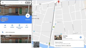
Have you noticed how Google Maps is assigning district names to Dublin’s streets? For example, it’s decided that Stirrup Lane is in “Inns Quay” (a designation taken up by a, ahem, most respectable website recently and that Green Street is in “Rotunda”. Inns Quay is nearly half a km from Stirrup Lane and the Rotunda is also 0.5 km away (as the crow flies) from the street designated as being in that “district”. Yeah, those districts are used for election nerds mapping voters but they’re not district names anybody else uses.


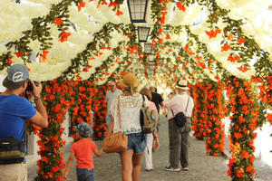


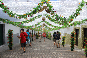


Scenes from Festas Do Povo 2015 (the Flowers Festival) at Alentejo in Portugal during which the entire city is dressed with paper flowers made by the citizenry.
If you’re passing, the festival continues until the end of August.