Tag Archives: Met Eireann

Met Eireann has announced that there is now Status Red wind warning (gusts of up to 150kph) out for Clare from 8pm until 11pm tonight, on account of Storm Hannah.

It’s also announced that similar gusts may reach Connemara, the Aran Islands, Dingle and the coasts of Kerry, Cork and Waterford.

Carlow Weather will be live tweeting updates from 5pm here

Earlier: Thar She Blows

Pic: Carlow Weather

UPDATE:

UPDATE:

Carlow Weather tweetz:

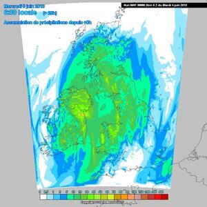
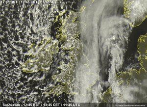
The outer bands of #StormHannah are approaching the Southwest coast with heavy rain showing on the Radar and the system is looking very well defined on Satellite image now. Winds will increase later this afternoon to severe gusts.

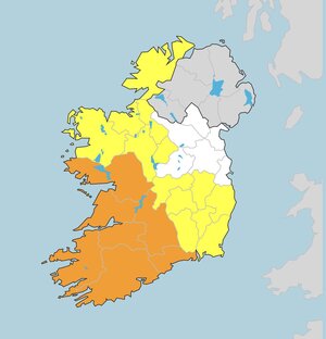
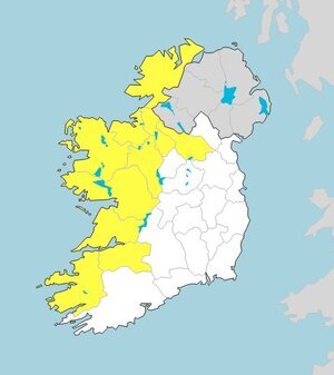
Met Eireann have issued several weather warnings:

A Status Orange wind alert (gusts of up to 130kph) for Clare, Cork, Kerry and Limerick which will be valid from 4pm today to 1am tomorrow.

A Status Orange wind warning for Galway from 7pm this evening to midnight.

A Status Orange wind warning for Tipperary and Waterford from 10pm tonight to 2am tomorrow.

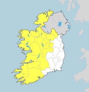
A Status Yellow wind warning (gusts of up to 110kph) for Connacht, Carlow, Kildare, Kilkenny, Laois, Longford, Wexford, Wicklow, Offaly, Donegal, Tipperary and Waterford from 11pm tonight until 9am.

Met.ie

Just now.

Met Eireann has issued a Status Yellow snow-ice warning for Wicklow, Donegal, Leitrim, Mayo and Sligo – to last from 10pm tonight until 11am tomorrow.

Eeek.

Meanwhile, earlier…

Sigh.

Pic: Carlow Weather

Again.

Met Éireann has issued a Status Yellow rain for Connacht, Longford, Offaly, Westmeath, Cavan, Monaghan, Clare, Cork, Kerry, Limerick and Tipperary, from 9pm tonight until noon tomorrow.

The rain may “turn to snow in parts for a time”.

On St Patrick’s Day, Sunday, the national outlook is that it will be a “cold and blustery day with sunny spells and passing showers, some with hail and thunder”.

Great.

Met Éireann

Gulp.

Met Éireann tweetz:

Here’s the latest infrared satellite image from 8am. Storm Erik is clearly visible just off the northwest coast. Gusts of up to 120km/h have been recorded this morning with the strongest winds in Galway, Mayo & Donegal.

Orange warning in effect as Erik brings 120km/h gusts (RTÉ)

Meanwhile..

Yesterday: Incoming

In the past hour.

Met Éireann has issued a Status Yellow snow-ice alert which will be valid from 9pm tonight until 7pm tomorrow night, saying:

“Icy and slippery conditions expected due to accumulation of ice and snow on untreated surfaces.

“Scattered sleet and snow showers most frequent across Ulster and Connacht will occur but some showers penetrating into central and eastern areas at times with the odd flurry further south.

“Accumulations generally 1-2cm expected. Wintry showers becoming confined to northern areas by late evening.”

Met Éireann warnings

This afternoon.

Met Éireann has issued a Status Yellow wind warning for Connacht, Cavan, Donegal, Clare, Kerry and Limerick.

They say:

“Southwest winds will reach mean wind speeds between 55 to 65km/h with gusts of 90 to 110km/h, strongest near coasts where these limits may be exceeded for a short period later on Thursday night.”

Met Éireann warnings