Tag Archives: globe

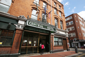
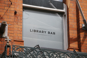
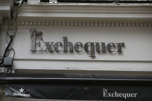
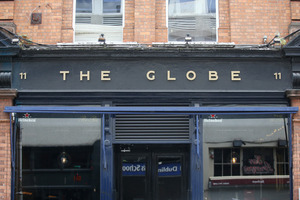
From top: Central Hotel on Exchequer Street, Dublin 2, The hotel’s Liubrary Bar, The Exchequer around the corner and the nearby The Globe

This morning.

Charlie Taylor, in The Irish Times, reports:

Some of Dublin’s most loved haunts could be about to disappear with planning permission being sought to partially demolish the Central Hotel on Exchequer Street and to the nearby Globe bar and associated Rí-Rá nightclub.

An application has been lodged for a major new development that consists of the reconfiguration, partial sundry demolition, and expansion of the Central Hotel into a new 6,554 sq m five storey hotel with 125 bedrooms and a rooftop extension.

Among the associated properties at risk because of the planned development include the Globe bar, sister establishment Rí-Rá and the Exchequer.

But look what you get.

A bigger hotel!

Central Hotel, Globe and Rí-Rá at risk under redevelopment plan (The Irish Times)

Rollingnews

The British Museum has digitised many of its 17th and 18th century globes into spinnable zoomable 3D models for your perusal. To wit:

During the so-called ‘Age of Exploration’, expanding European geographical and astronomical knowledge fuelled the demand for maps and sea charts. It also inspired experimentation in the art of globe-making, and the first half of the 16th century saw the production of several models, both hand-painted and printed. Printing made it possible to produce globes in greater numbers at lower cost so they could be more widely distributed. The printed globe, terrestrial and celestial, soon became established as the standard type of globe, sometimes called the ‘common’ globe, and the methods of manufacture changed surprisingly little from the mid-16th century until the 20th century.

Explore them here.

kottke

Behold: the largest known early map of the Earth, created in the form of 60 panels designed to be assembled into a large circle by Italian cartographer Urbano Monti in 1587. A manuscript of all 60 panels, recently acquired by the David Ramsey Map Centre, can be viewed in digitised detail here.

Of great interest is the attempt Monte makes to make his map not just a geographical tool but to show climate, customs, length of day, distances within regions — in other words, to create a universal scientific planisphere. In his dedication on tavola XL he specifies how to arrange the sheets of the mappamondo and makes it explicit that the whole map was to be stuck on a wooden panel 5 and a half brachia square (3.25m) so that it could be revolved around a central pivot or pin through the north pole.

And if you want the full 3D experience, a fully zoomable and rotatable globe visualisation of Monti’s map (Pic.5, above created by Jeremy Ashkenas) can be played with here.

kottke

Isis-painting-Curve-2-by-Gareth-Pon8e2ac88adcba76af821df9f2195354dd Mini-Globes-and-Livingstones-by-Gareth-Pon d7ef5b1b3122201e3fa55e5f685bd97b Studio-by-Gareth-Pon Photo-credit-Stuart-Freedman

In the age of Google Earth, the once artful oeuvre of globe-making has been largely replaced by poor quality mass produced products.

Not so the elegant watercoloured earthballs emanating from the open plan workshop of Bellerby & Co. Globemakers of Stoke Newington, London – as documented in this short by Cabnine Films.

colossal