Tag Archives: satellite

A 2019 short by Swiss animators Frederic Siegel and Benjamin Morard in which:

Leaving for his dream job, a satellite technician keeps solitude at bay by constantly texting with his old friends. After neglecting his duties a satellite leaves its orbit which causes the worlds network to collapse.

shortoftheweek

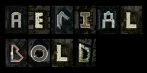
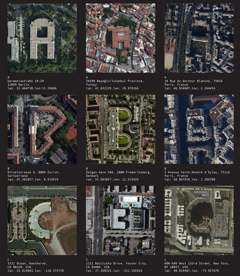
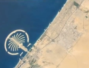
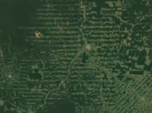
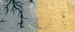
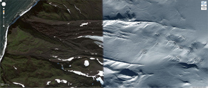
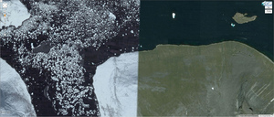
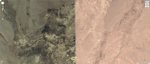
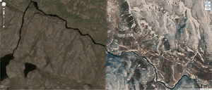
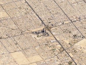
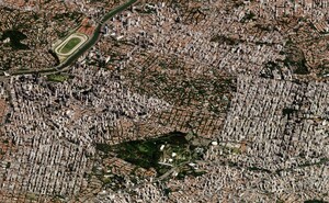
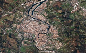
A gallery of satellite images taken – not vertically – but at an angle, published by Planet Labs.

To wit:

…the satellite imagery we’re most familiar with — taken straight down — flattens and obscures the visual cues we get from perspective, making the imagery appear like maps, not photos… from an angle, the view becomes altogether different: the mountains rise to their commanding height, valleys regain their depth, and background features recede into the distance. It’s like getting a view out the window of an airplane 450 kilometers high.

From top: Monte Fitz Roy in Patagonia; Riyadh, Saudi Arabia; Sao Paulo, Brazil; Klyuchevskaya volcano in Russia and Bilbao in Spain.

kottke

a0fe42d5ef3d26d8cbfcb97700b3baac_large Screen Shot 2014-10-28 at 12.02.04
A proposal by ‘computational and speculative designer’ Benedikt Groβ and San Francisco based geographer Joey Lee to ‘run a satellite image based alphabet searching algorithm’ to identify man made structures that look like letters of the alphabet when viewed from above. They say:

..we will traverse the entire planet’s worth of satellite imagery and develop the tools and methods necessary to map these features hiding in plain sight.

Well might you scoff, but the project is already fully funded on Kickstarter.

quipsologies

8497576409_c51854d381_b 8497578983_d276bcaf0b_b 8498679828_05bcdefb52_b 8498682256_077c7cc146_b 8498682454_cd62eb1c52_b 8498683082_72ccd5038a_bGoogle Earth images are compiled from different datasets of satellite imagery taken months, perhaps years apart. Sometimes the process of stiching the smaller images together includes anomalies such as differences in the appearance of the terrain during different seasons.

In his ‘Juxtapose‘ project, artist Daniel Schwartz  compiles tasty examples of this split screen exotica.

22words/itsnicethat

NASA already has a long history of compositing images of the earth (front and back).

Now the Russians have gone one better with their geostationary Electro-L weather satellite: its 121 megapixel images (1 km per pixel) were used to create the above timelapse video of the phases of Gaia.

This requires nothing less than full screen and 1080p for the required effect.

theverge